North Rhine-Westphalia in the Roman Empire

The area on the left bank of the Rhine in what is now North Rhine-Westphalia belonged to the Roman Empire for around 500 years - from its conquest by Caesar in 55 BC to 459/461 AD, when Cologne was taken by the Franks.
Before the Roman occupation, North Rhine-Westphalia was part of what was called Germania magna (‘Greater Germania’).
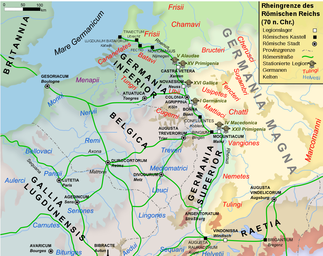
During Roman times, North Rhine-Westphalia belonged to various Roman administrative units. At first it was part of the province of Gallia Belgica, and from 16 AD it belonged to the army district of ‘exercitus Germania inferior’.
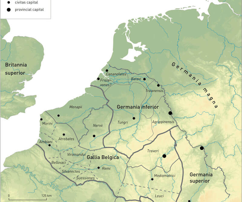
It was not until around 85 AD that what is now North Rhine-Westphalia, along with parts of the Netherlands, Belgium and a piece of Rhineland-Palatinate, became the province of Lower Germania (Germania inferior). The capital and seat of the provincial governor was Colonia Claudia Ara Agrippinensium (CCAA), today the city of Cologne.
Before the Roman conquest, a number of tribes and peoples generally referred to as Germanic tribes lived in what is now North Rhine-Westphalia. The term, ‘Germani appears to have been put on record for the first time in 80 BC by the Greek writer, Poseidonios of Apameia. It is possible that, during Caesar's time, a small group of tribes on either side of the Lower Rhine used the term to refer to themselves.
In his Commentaries on the Gallic War, Caesar uses the term, ‘Germanic’ for the verious ethnic groups that lived in the areas east of the Rhine and between the North Sea, the Baltic, the Vistula and the Danube. His writings helped lift the veil of obscurity from these tribes.
These "Germanic" groups shared no country or state, but identified in line with their respective tribal communities and often waged war among themselves.
It is not clear whether the tribal names familiar to us were the ones actually used or whether they were Roman designations. Not all of the tribal groups mentioned by the ancient sources existed at the same time; some also joined together to form larger associations or merged into one another. The boundaries of the tribal territories according to the recorded history cannot be scientifically determined through archaeological discoveries. Instead, archaeologists divide the individual groups according to regional similarities, e.g. according to settlements and housing types or everyday objects abd utensils. Based on that, the native population can be culturally classified into the groups of North Sea Germanic, Rhine-Weser Germanic or Elbe Germanic.
In his Commentaries on the Gallic War, Caesar cites an alleged conspiracy by the Belgae as the motive for his invasion of what was then free Gaul (parts subsequently covered ly Germania) in 58 BC. At the same time, however, he was apparently aiming to conquer for Rome the whole territory up to the Rhine. However, the option of securing new resources and generating profits through the conquests was certainly equally important. In addition to slaves, the conquered territories yielded mineral resources such as iron, lead, zinc, tuff and greywacke, wood and, over time, surplus farming produce to supply the army.
What the Romans left to all those who live in present-day North Rhine-Westphalia can not only be seen but also tasted:
cherry, melon, plum, peach, fig, sweet cultivated forms of apple and pear, but also spices such as dill and parsley were brought to us here in the cold north by the Romans.
A little further south, in Rhineland-Palatinate, Riesling has been growing for almost two thousand years as the old "Roman grape".

Spelt, which grows in our regions, was initially unknown to the Romans, but quickly became an acquired taste.
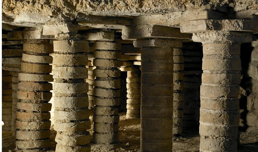
Today, we can marvel at the remains of Roman amenities in many places in North Rhine-Westphalia - but it took a while to re-appreciate them:
running water, hot baths and swimming pools, flush toilets and underfloor (central) heating are conveniences that were not available to many people in North Rhine-Westphalia again until some 1500 years later, and in some cases not until after the Second World War.
Like we do today, the Romans also wanted to get from a to b as quick and straight as possible: Many of our roads in North Rhine-Westphalia still follow the track of some ancient Roman roads - often dead straight and without any major gradients from one place to another. Even back then, of course, the roads were in excellent condition, well signposted and with rest stops including ‘service stations’ (to change horses) at appropriate intervals.
Mind you, all these achievements were based on techniques from ancient Greece - but the refinements added by Roman engineers, builders, legionaries and craftsmen are really something!
In the Gallic Wars of 58-51 BC, Gaius Julius Caesar conquered the area up to the river Rhine by largely destroying the Eburon tribe. However, this new river border would not yet be fortified. The conquered territories were assigned to the existing province (administrative unit) of Gallia Belgica.
Probably from 19 BC onwards, the expansion of the Roman border area on the Lower Rhine went on. Governor Marcus Vipsanius Agrippa built a network of long-distance roads and resettled the Ubian tribe from the right to the left bank of the Rhine. In 7 BC he founded the oppidum Ubiorum as their headquarters and set up a Roman administration.
In order to protect the Rhine border, the Roman commander Nero Claudius Drusus, brother of the future Emperor Tiberius, established the camps of Bonna (Bonn), Asciburgium (Moers-Asberg), Novaesium (Neuss) and Vetera (Xanten) in 13/12 BC.
The resettlement of 40,000 Germanic tribes (probably Sugambrians) from the right bank of the Rhine to the area between Krefeld and Kleve provides further political stabilisation on the Lower Rhine.
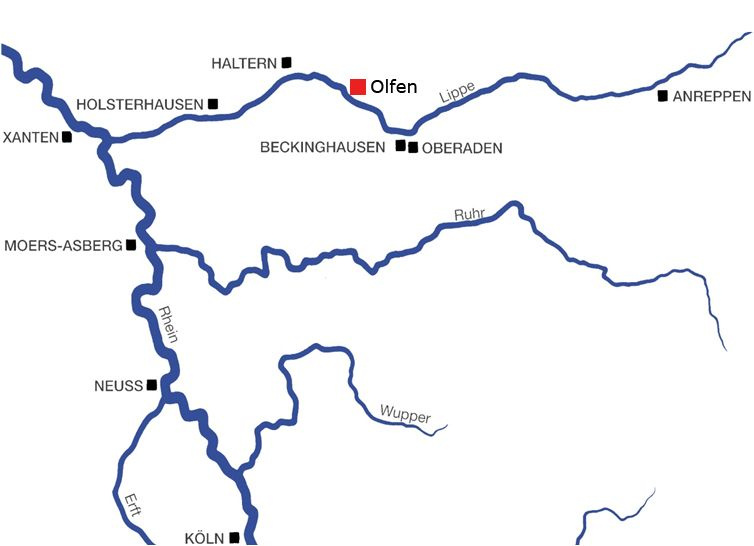
In their attempts to annex the area to the right of the Rhine as far as the Elbe to the Roman Empire, the Romans advanced along the Lippe and the Hellweg.
Judging from the timber used for building, twin camp of Oberaden (city of Bergkamen) dates back to 11 BC. A small riverside fort in Beckinghausen (Lünen) ensured supplies across the Lippe. At the same time, it is assumed that marshland forts were built in Holsterhausen (Dorsten) and Haltern am See. The camp of Bielefeld-Sennestadt is dated to the time around the birth of Christ. The Roman camp at Anreppen was probably built in 4 AD, presumably as a winter camp for the commander Tiberius.
The overwhelming defeat of the Roman commander Publius Quinctilius Varus by the Cheruscan Arminius in 9 AD, probably at Kalkriese in the Wiehen Hills, ended Roman rule on the right bank of the Rhine. Punitive expeditions by the Roman commander Germanicus between 11 and 16 AD against the Germanic tribes lead to a brief reconquest of the territory lost after the Varus Battle, but could not permanently pacify the areas on the right bank of the Rhine. Emperor Tiberius abandoned the campaigns and established the Rhine as the border between the Romans and the Germanic tribes.
With the final establishment of the Rhine as the border, the later province of Lower Germania became an army district of its own in 16 AD. Four legions remained in North Rhine-Westphalia, one each in the camps of Neuss and Bonn and two at Vetera/Xanten.
In 50 AD, Emperor Claudius elevated the oppidum Ubiorum to the status of Colonia (city with Roman citizenship) Claudia Ara Agrippinensium (Cologne). Numerous country estates were built in the area.
During an uprising in 69 AD, the Batavians conquered the legion’s camps of Vetera (Xanten), Novaesium (Neuss) and Bonna (Bonn). It took the Romans over a year to suppress the uprising.
After the situation stabilised, the army district became the province of Lower Germania around 85 AD. At the same time, the province of Upper Germania (parts of south-west Germany, France and Switzerland) with the capital Mogontiacum (Mainz) was established. To protect the two provinces and the province of Raetia (north-western Alpine region, northern Alpine foothills), the Romans begin to fortify the border with buildings (Lower Germanic Limes and Upper Germanic-Raetian Limes border sections).
The province of Lower Germania underwent an upturn from the end of the 1st century. The provincial capital Cologne was expanded. Around 89/90 AD, the riverside section of the city wall was constructed and the Eifel water pipeline to Cologne built. Around 100 AD, Emperor Trajan founded the Colonia Ulpia Traiana (CUT) near Xanten. Until 230 AD, life in North Rhine-Westphalia seems to have been predominantly peaceful. In 212 AD, all freeborn inhabitants of the Roman provinces were granted Roman citizenship by the ‘Constitutio Antoniana’.
From 233 AD onwards, Germanic invasions caused unrest in Raetia and Upper Germania.
In 259/60 AD, the Romans abandoned the Upper Germanic-Raetian Limes and retreated behind the Rhine and Danube. Further Germanic invasions into Upper Italy led to the construction of the Aurelian Wall in Rome in 270 AD.
Numerous raids by Germanic tribes are also documented in the province of Lower Germania from the middle of the 3rd century AD. In 275 AD, Colonia Ulpia Traiana and the Vetera II fort near Xanten were largely destroyed by Germanic tribes. Many settlements were secured with wall fortifications and burgi (Latin burgus = small fortification) during this period, and numerous villae rusticae (Latin villa rustica = estate) were decimated.

Around 300 AD, the province of Germania inferior was renamed Germania secunda as part of administrative reforms.
Due to the continuing threat and the destruction of entire regions by Germanic tribes, new forts were built in the Rhineland during this period, such as the fort Tricensimae (Xanten), Divitia (Deutz/Cologne) or Haus Bürgel (Monheim).
An important change for the life of the people also in the Lower Germanic province is the elevation of Christianity to the state religion in 380 AD. In 391/392 AD, pagan cults are expressly banned - apparently the new state religion had not yet established itself.
As the conflicts on the borders of the Roman Empire become too much, in 395 AD it was divided into a Western Roman Empire and an Eastern Roman Empire.
For the Rhine provinces, however, this decision brought no relief. From 400 AD onwards, the situation for the population became worse. The military left the Rhineland, Germanic tribes invaded the Rhine provinces and Gaul. In 410 AD Rome was conquered by the Visigoths, and in 411 AD the Romans finally abandoned the Rhine frontier. Remaining Roman territories gradually fall to Germanic invaders. Cologne was conquered by the Franks in 459/461 AD. This marked the end of Roman rule on the Rhine.
In 475 AD Trier was also conquered by the Franks and 476 AD marked the end of the Western Roman Empire. The last ruler, Romulus Augustus, was deposed by the Germanic army leader, Odoacer.