World Heritage Site Lower German Limes
The Lower Germanic Limes was an important border section of the Roman Empire. It followed the ancient course of the Rhine and extended for about 400 kilometres between Katwijk (NL) on the North Sea to Bad Breisig in Rhineland-Palatinate.
From around 19 BC, Emperor Augustus based his legions on the left bank of the Rhine. Under Emperor Tiberius (reigned 14-37 AD), ambitions to subdue the territories on the other side of the river as far as the Elbe ended. From then on, the Rhine separated the Roman army district on the left bank from the Germanic settlement areas on the right bank.
The Romans used the river as a natural shield. Unlike other sections of the Limes, no linear border fortifications were necessary here at the ‘wet Limes’.
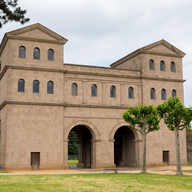
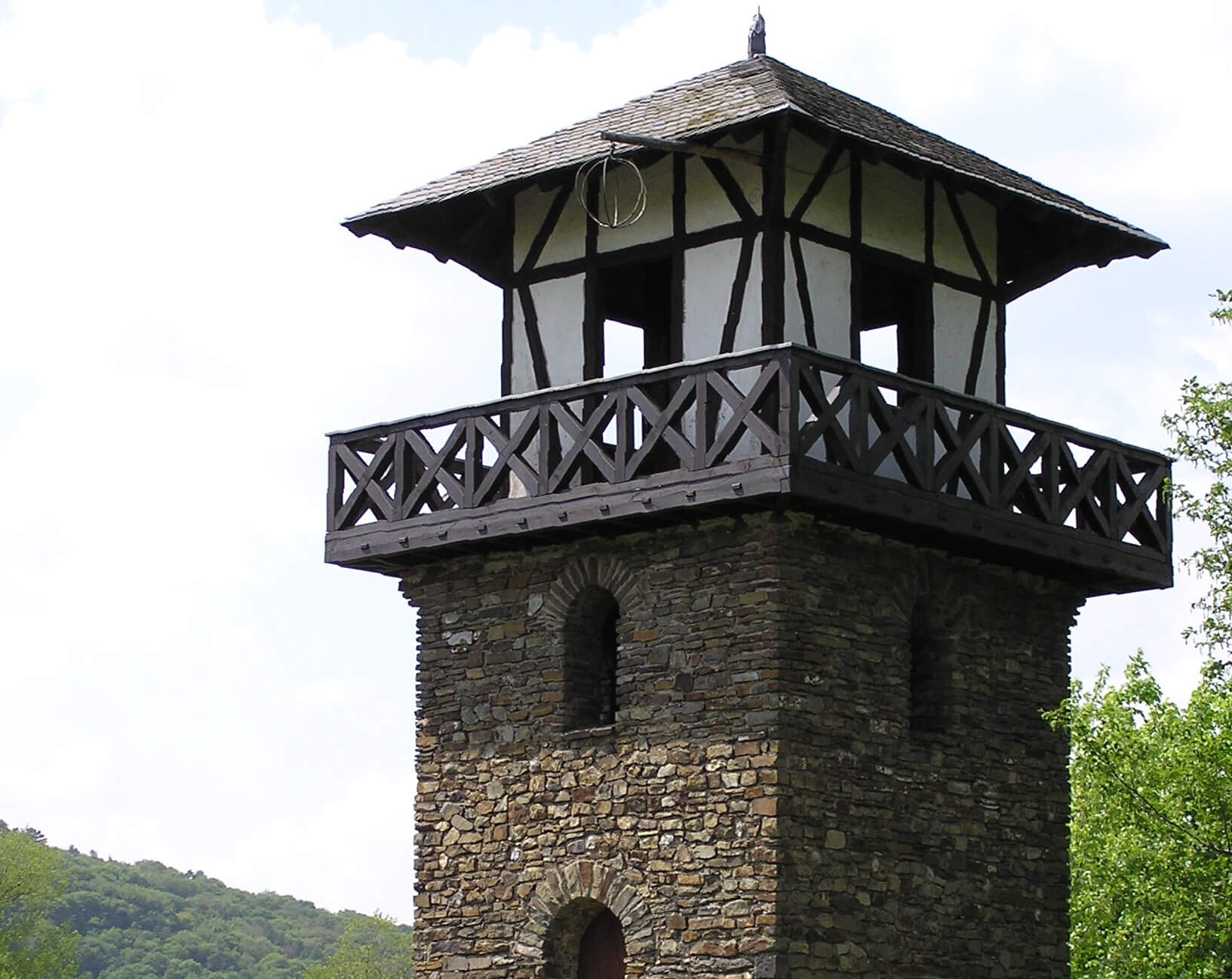
To protect the border, a large part of the Roman army was situated along the Lower Germanic Limes. This part of the army, the exercitus Germaniae inferioris, also included the Rhine fleet, the classis Germanica. Along the Rhine, military camps and forts as well as some watchtowers lined the left bank. They were connected by the so-called Limes Road, the course of which is largely identical to that of today's Bundesstraße 9. This major highway was equally important for military and civilian traffic.
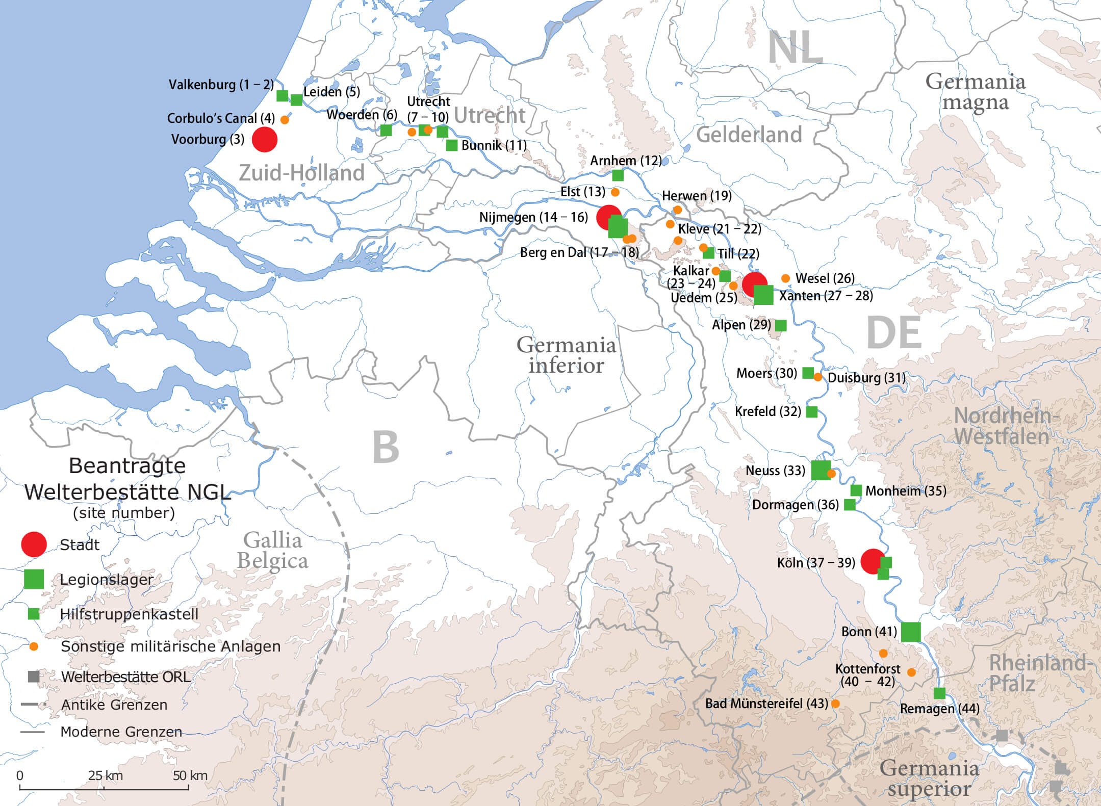
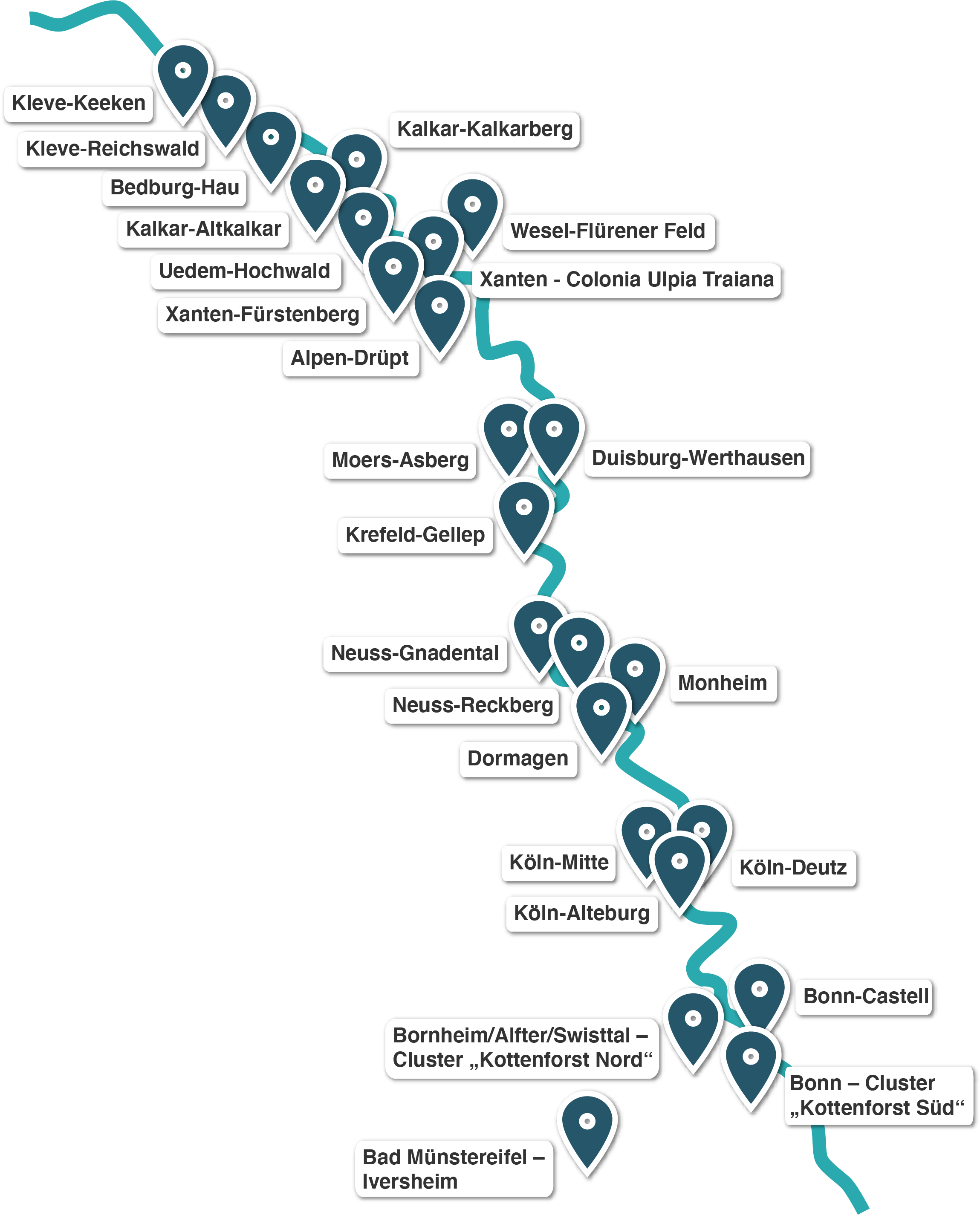
The archaeological sites of the Lower Germanic Limes illustrate in a special way the development of a border of the Roman Empire as well as the life and cultural exchange in its surroundings. Because of their outstanding universal value, UNESCO has recognized a representative selection of 44 archaeological sites on the Lower Germanic Limes as a World Heritage Site in July 2021. A total of 24 of these sites are located on German territory, distributed among 19 municipalities in North Rhine-Westphalia and one in Rhineland-Palatinate.
Since its recognition as a World Heritage Site, the Lower Germanic Limes is also part of the already existing serial and transnational UNESCO World Heritage Site "Frontiers of the Roman Empire".
The application and World Heritage partners are the Kingdom of the Netherlands and the states of North Rhine-Westphalia and Rhineland-Palatinate. The LVR Office for the Preservation of Archaeological Monuments in the Rhineland is responsible for the preparation of the application and the technical supervision of the World Heritage Site in North Rhine-Westphalia. If you have any questions or suggestions concerning the Lower Germanic Limes, the contact persons there will be happy to help you.
Some of the most important military bases and civilian centers of the Lower Germanic Limes were located along the approximately 230-kilometer-long border section in what is now North Rhine-Westphalia. Here you will learn more!
Today, a section of the Lower Germanic Limes about 20 kilometres long lies in Rhineland-Palatinate.
Its southern end is marked by the fort Rigomagus with its civilian settlement and burial grounds, which was located in the town of Remagen and existed from 5 BC to around 450 AD. South of it, in the Vinxtbach valley near Bad Breisig, ran the border between the two Roman provinces of Lower and Upper Germania.
On the opposite bank, a little further up the Rhine, the Upper Germanic-Raetian Limes began, of which the small fort of Rheinbrohl is a part.
In the Netherlands, the Lower Germanic Limes ran along the course of the Rhine in Roman times through the present-day provinces of Gelderland, Utrecht and Zuid-Holland from Nijmegen to Katwijk an Zee. This section is about 120 kilometres long.
Important sites along the Lower Germanic Limes in the Netherlands include Matilo/Leiden-Roomburg, Fectio/Vechten or Noviomagus/Nijmegen, where the Romans built a large legionary camp. In Utrecht, the remains of the Roman fort Traiectum can be visited under the Domplein in the centre of the city.
