
Explore the
Romans

Twee legionairs op wacht in het Romeinse kamp Haltern

Whether through towns, streets or buildings - the Romans left their mark on North Rhine-Westphalia for almost 500 years. This is still visible almost everywhere today.

At roemer.nrw you will find everything about life in the Roman era in North Rhine-Westphalia.

Discover exciting archaeological sites, museums and discoveries - and perhaps you will see your own town in a whole new light!


You can not miss this

Sarkophage (nicht zugänglich)

Giesdorfer Allee 100
50997 Köln
Deutschland

Die zu einem Gutshof in Godorf, Godorfer Hauptstr. 171, zugehörigen Sarkophage sind im 400 m entfernten Garten aufgestellt.

N 50°51'50" E 6°57'54"
> Learn more

Abschnitt Via Belgica

Kaeks
52382 Quadrath-Ichendorf
Deutschland

Die Via Belgica war die römische Fernstraße von Köln nach Boulogne-sur-Mer. Etwa 60 Kilometer der Straße liegen im heutigen Rheinland. Sie verläuft von dort durch die niederländische Provinz Zuid Limburg über die Wallonie in Belgien bis zur Küste an den Ärmelkanal.

N 50°56'7" E 6°40'49"
> Learn more

Meilenstein

Bergheimer Straße
53909 Zülpich
Deutschland

N 50°42'8" E 6°39'29"
> Learn more

Kastell

Marktplatz 11
52428 Jülich
Deutschland

N 50°55'20" E 6°21'27"
> Learn more

Abschnitt Via Belgica, villa Rustica

In der Widdau, Dechant-Hansen-Allee
50226 Frechen
Deutschland

Die Via Belgica war die römische Fernstraße von Köln nach Boulogne-sur-Mer. Etwa 60 Kilometer der Straße liegen im heutigen Rheinland. Sie verläuft von dort durch die niederländische Provinz Zuid Limburg über die Wallonie in Belgien bis zur Küste an den Ärmelkanal.

N 50°56'23" E 6°45'31"
> Learn more

Radroute „Via Romana“

Wirtschaft, Tourismus & Marketing Stadt Kleve GmbH
Minoritenplatz 2
47533 Kleve
Deutschland

Die ca. 260 km lange Route „Via Romana“ Rad-Touristen durch 2.000 Jahre Geschichte, entlang der niederrheinischen Naturlandschaften, vorbei an mittelalterlichen Stadtkernen, sehenswerten Museen bis hin zu Parkanlagen und Schlössern. Startpunkte sind die ehemaligen Römersiedlungen Ulpia Noviomagus Batavorum – heute Nijmegen, die älteste Stadt der Niederlande – und die Colonia Ulpia Traiana bei Xanten.

N 51°47'52" E 6°8'39"
> Learn more

Stadtmauer - Zeughausstraße

Zeughausstr. 1-3
50667 Köln
Deutschland

Das Zeughaus (heute: Kölnisches Stadtmuseum) ist auf der Stadtmauer errichtet worden; an der südlichen Gebäudefront ist diese sichtbar; im weiteren Verlauf bis Mohrenstr./Auf dem Berlich ist die Stadtmauer (teils neuzeitlich verblendet) rund 90 m lang sichtbar

N 50°56'29" E 6°57'2"
> Learn more

LVR-LandesMuseum Bonn

Colmantstr. 14-16
53115 Bonn
Deutschland

Im LVR-LandesMuseum erwartet den Besucher eine erlebnisreiche Zeitreise vom Neandertaler bis in die Gegenwart. Es präsentiert herausragende Funde, Schätze und Kunstwerke aus 400.000 Jahren. Ein vielfältiges Angebot von Workshops und Veranstaltungen lädt Kinder, Jugendliche und Erwachsene zu immer neuen Entdeckungsreisen durch die Geschichte ein.

N 50°43'55" E 7°5'36"
> Learn more

Römervilla Blankenheim

In den Alzen
53945 Blankenheim
Deutschland

Neben thematischen Rad- und Wanderwegen lassen sich in Blankenheim auch die Reste eines römischen Landguts ("Villa rustica") finden, das zu den größter dieser Art im Rheinland gehörte. Mit moderner Architektur wurde hierbei die Säulenvorhalle, der Porticus, rekonstruiert und für die Öffentlichkeit zugänglich gemacht. Sehenswerte römische Hinterlassenschaften können im Römerinformationszentrum des Eifelmuseums/Gildehaus begutachtet werden.

N 50°26'31" E 6°38'32"
> Learn more

Abschnitte Agrippastraße

Römerstraße, Lechenich
50374 Erftstadt
Deutschland

Übergänge der Agrippastraße am Rotbach mit Brandgräbern sowie an der Erft, Abschnitt Agrippastraße in Erftstadt.

N 50°47'52" E 6°47'35"
> Learn more
Do you know more Römer offers?

We look forward to receiving your tips and photos to
roemer [at] mhkbd.nrw.de (roemer[at]mhkbd[dot]nrw[dot]de) !

Romans in North Rhine-Westphalia
A photo of the columns of the reconstructed harbor temple in the LVR Archaeological Park Xanten.
The Roman Empire

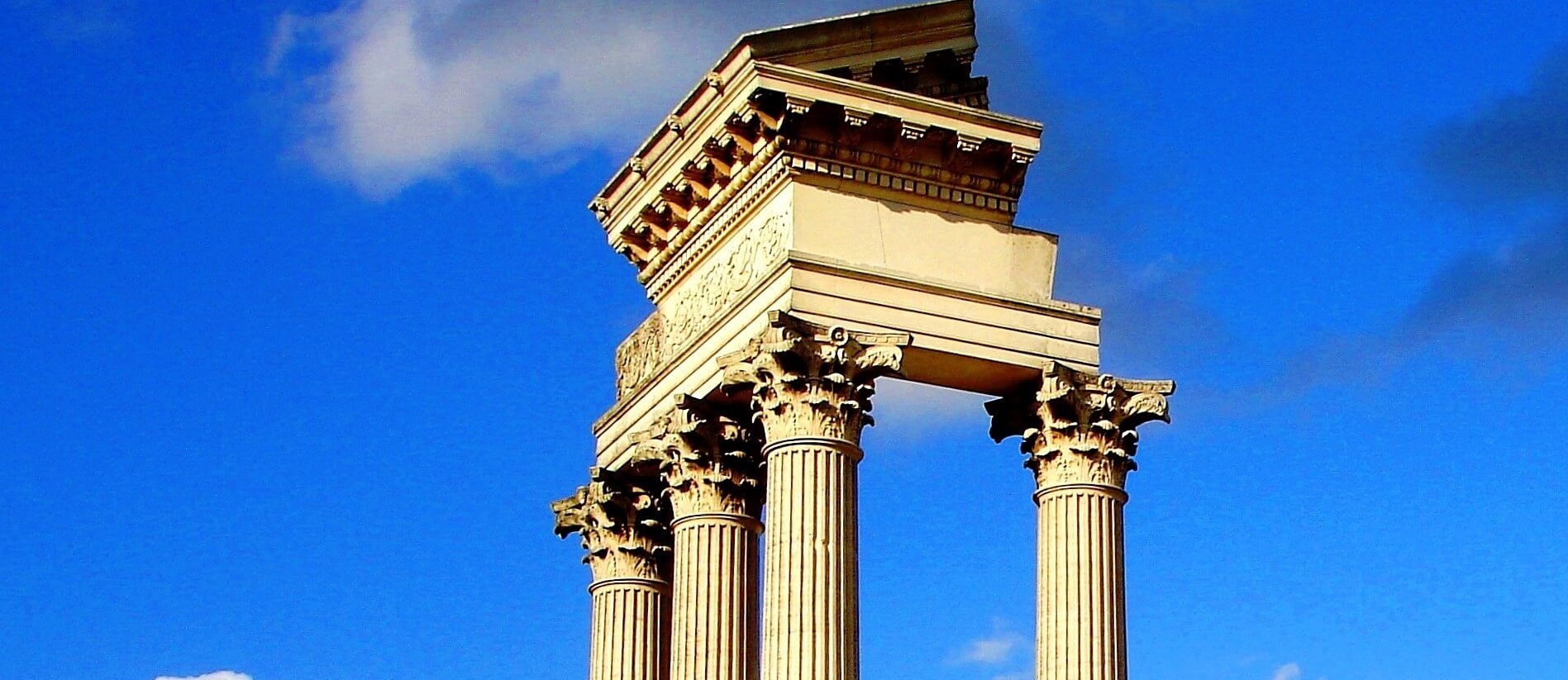
Starting out as a small city state, Rome became a world empire in the course of just under 700 years. But how did the Romans manage to become so powerful? And how come we not all Romans today?


North Rhine-Westphalia in the Roman Empire

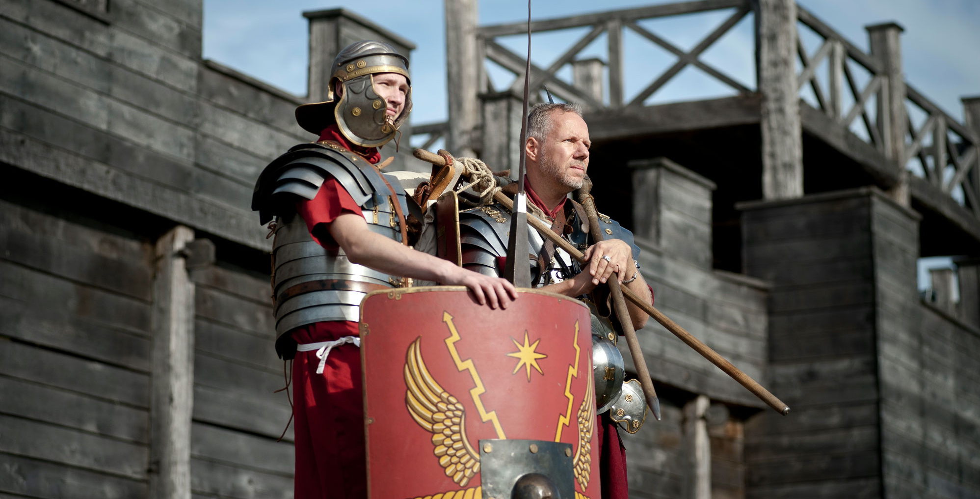
What do cherries, the flush toilet, concrete and underfloor heating have in common? All these amenities were the export success stories of an old advanced civilisation - "ancient Rome". Roman legionaries, merchants, craftsmen, traders and settlers brought numerous innovations to the banks of the Rhine. Did all the locals appreciate this? 


Model of the Roman fort Dormagen
The Limes - The borders of the Roman Empire
Legionnaires on a reconstructed section of the Roman camp fortification in Roemerpark Bergkamen

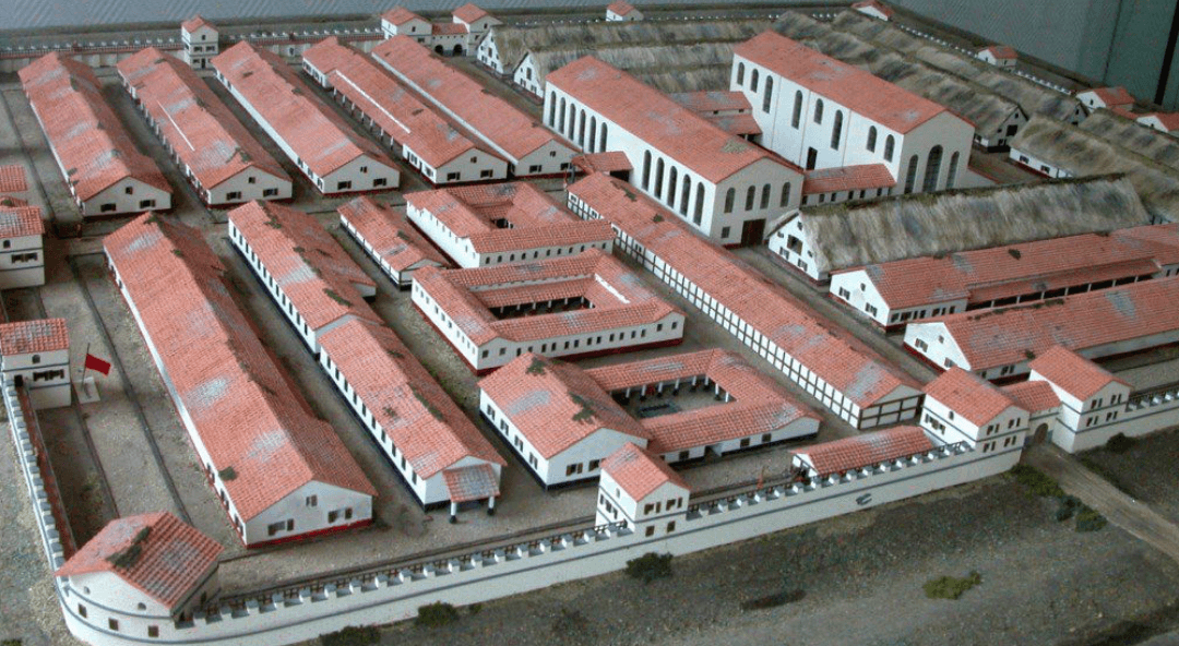
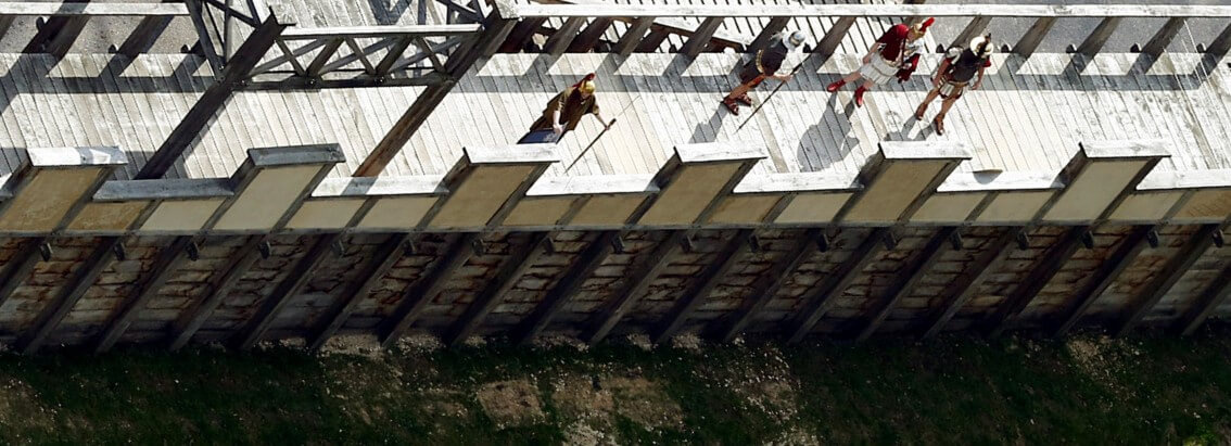
The Limes was the border of the Roman Empire. At the time of its greatest expansion, it ran through an area today covered by more than 20 countries and had a total length of 7,500 kilometres. Depending on local conditions, the various sections of the Limes looked quite different from one another. 

In the North, large parts of the Limes ran along the Rhine, Main and Danube rivers. It was a wet frontier protected by a chain of forts and legionnaire encampments. In what is today Germany, there were sections of the Lower Germanic Limes, the Upper Germanic-Rhaetian Limes and parts of the Danube Limes.