All roads lead to Rome ...
While long-distance roads, river routes and harbours existed long before the Romans, as the new rulers in the conquered territories they expanded the old paths and ensured that transport became faster and more controllable. The Romans were masters of road construction and created a comfortable network of long-distance roads that were not only easy on wheels, hooves and feet, but were also very well thought out logistically. Dead straight roads led quickly from one place to another. Rivers were used for heavy transport. The Rhine in particular played an important role as a "highway" between the Alpine region and the North Sea coast.
Roman roads are relatively easy for archaeologists to trace, as the Romans favoured well-defined urban and military structures and very straight long-distance roads.
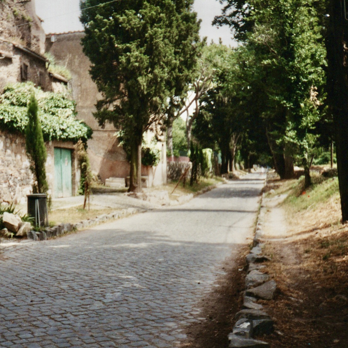
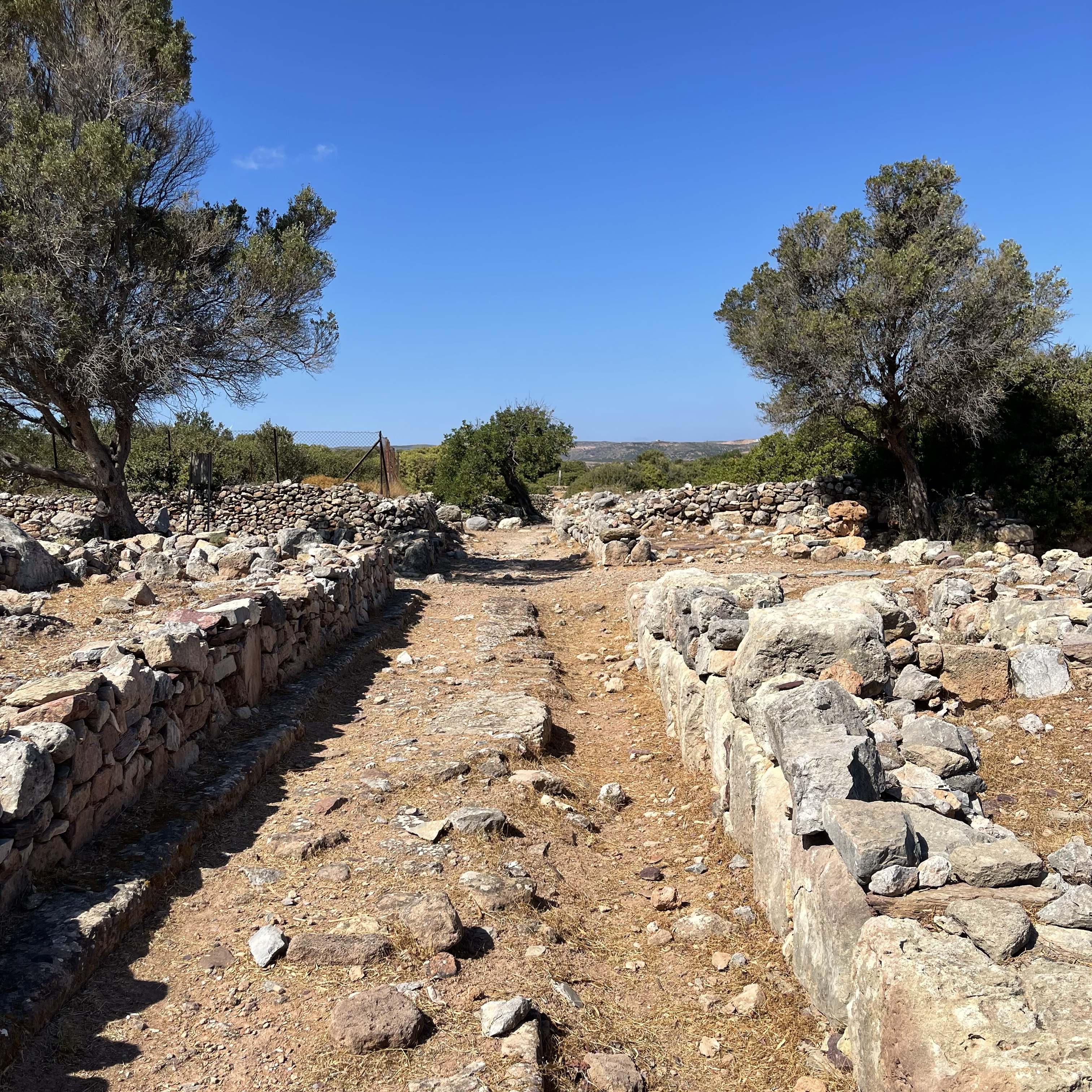
Probably the most famous of all Roman highways is the Via Appia, which led from Rome to Brindisi, 500 kilometres away. Even today, it is still possible to walk many kilometres along this road and admire Roman tombs on both sides of the dead straight route. Deep furrows have been cut into the old pavement over the centuries. They are the result of the countless horse-drawn carts and donkey carts that travelled here every day, not only in ancient times, but even after the Middle Ages. But despite its fame, the Via Appia was just one of thousands of Roman roads that ran through the Roman Empire.
Many Roman roads are also recorded in North Rhine-Westphalia, although we need to take a closer look. We can often assume that a road that bears the modern name "Roman road" already existed in ancient times. And from the characteristic structures of Roman military or civilian settlements, the course of the main roads and arterial roads is almost automatically determined, even if only parts of them have been archaeologically excavated. In all cases, the most direct connection - an almost straight line - between places must be assumed. Sometimes natural obstacles required a compromise. For example, the river meanders of the Rhine along the long-distance road close to its banks were recorded with as few "bends" as possible and as straight as possible.
Many Roman trunk roads were excavated during modern construction. The archaeologists generally knew the approximate course of the road beforehand and were on site as soon as the work began. With modern prospection methods, it is also possible to prove the course of a Roman road without excavation: Aerial archaeology, geo-laser scanning and geomagnetics make artificial structures visible in the landscape.
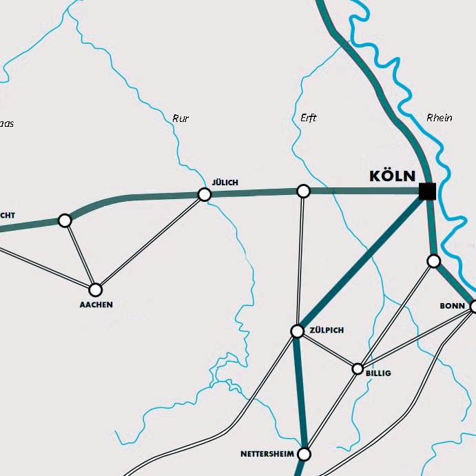
Some roads in North Rhine-Westphalia date back to the earliest development in Augustan times under the general and governor Agrippa. Today's Bundesstraße 9 is essentially the Roman Rhine Valley Road, a very long long-distance road that led from Italy across the Alps and then followed the Rhine from Strasbourg via Mainz, Bonn, Cologne, Xanten and further downstream.
Another important long-distance road, the Via Belgica, has largely disappeared under the fields of the fertile loess zone in the Voreifel region and in the large open-cast lignite mine Garzweiler II. The Via Belgica connected Cologne with the Atlantic coast, some 400 kilometres away, and allowed civilian towns such as Jülich, Maastricht and Tongern to flourish economically.
The third long-distance route to be highlighted here is the one from Trier to Cologne. It led through the Eifel, via Bitburg and Zülpich and is also documented in many sections. Settlements also existed along this long-distance road, which benefited from the connection as trading centres. Rich grave finds and luxurious settlements in rural areas indicate a particular prosperity.
Roman long-distance roads were characterised by their often dead straight course. For the streets in the cities, the Romans adopted the old Hippodamian principle or "chequerboard pattern": streets running at right angles that divided the urban area into rectangular islands of buildings (insulae).
In the non-urban street settlements, there were generally only a few houses lined up next to each other, but these were always orientated to the street. The narrow front of a Roman strip house formed the street front. This part of the building usually housed small shops, workshops, taverns and hostels, so that travellers passing through could find the most important goods and services here. Streets were therefore the main arteries of society.
Roman roads were constructed with particular care. The archaeological traces reveal a high level of engineering skill that was adapted to the respective terrain conditions and requirements.
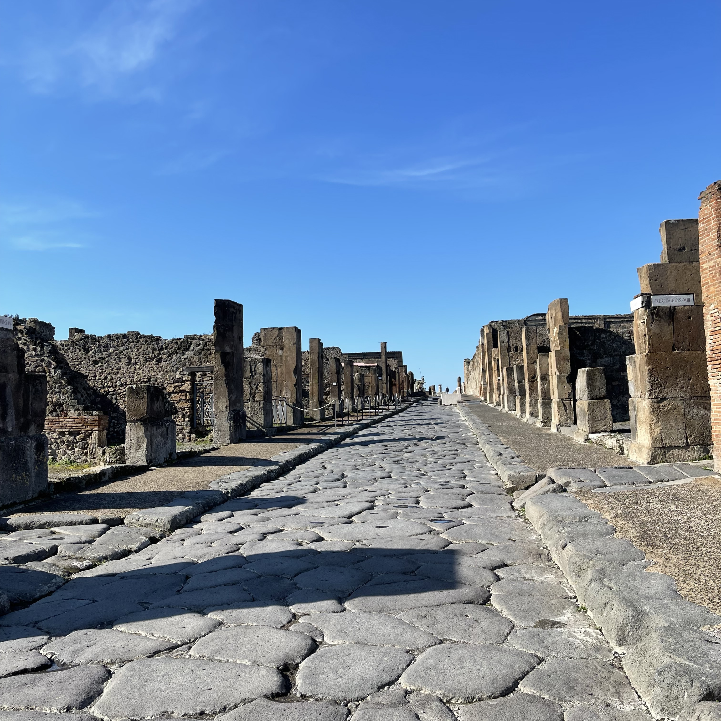
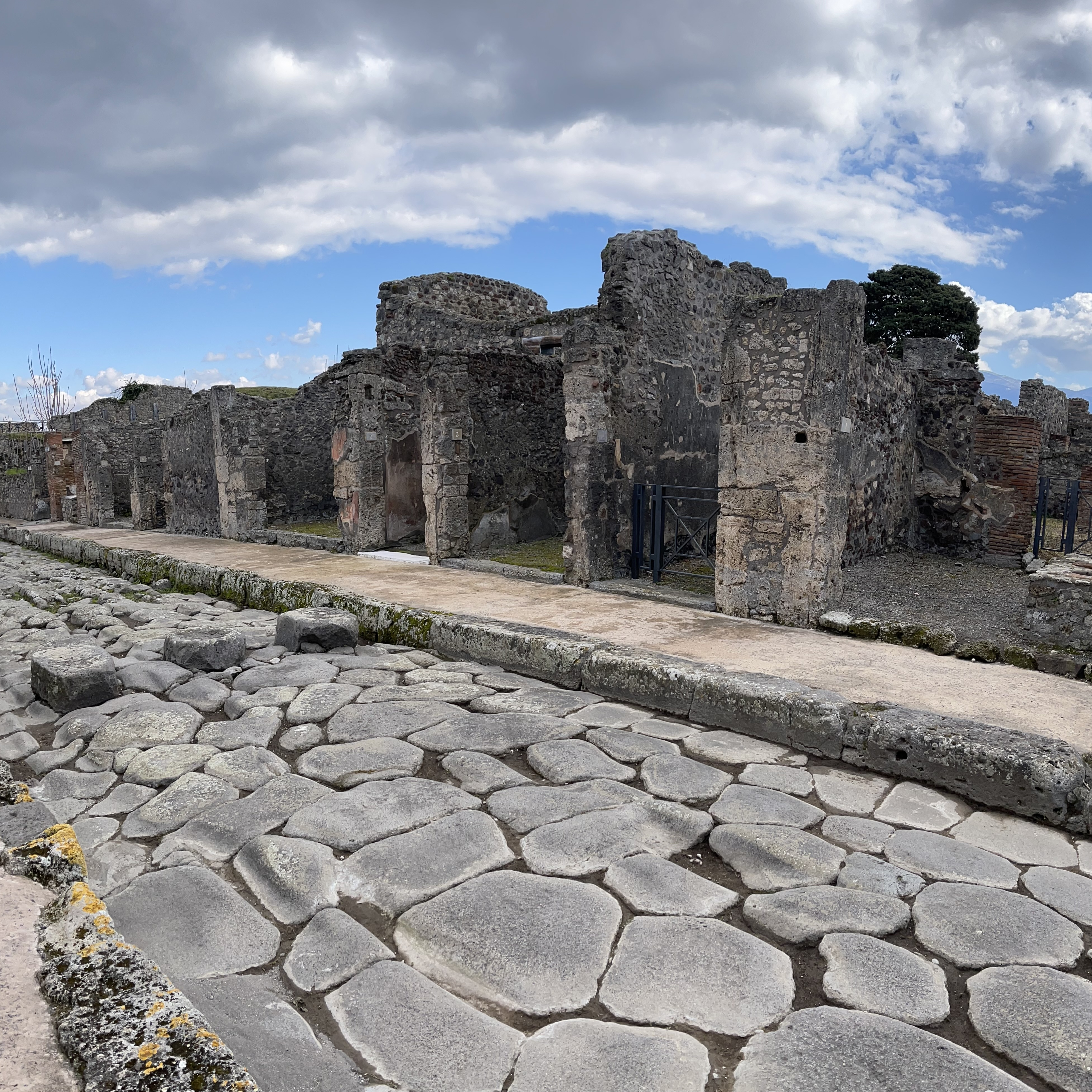
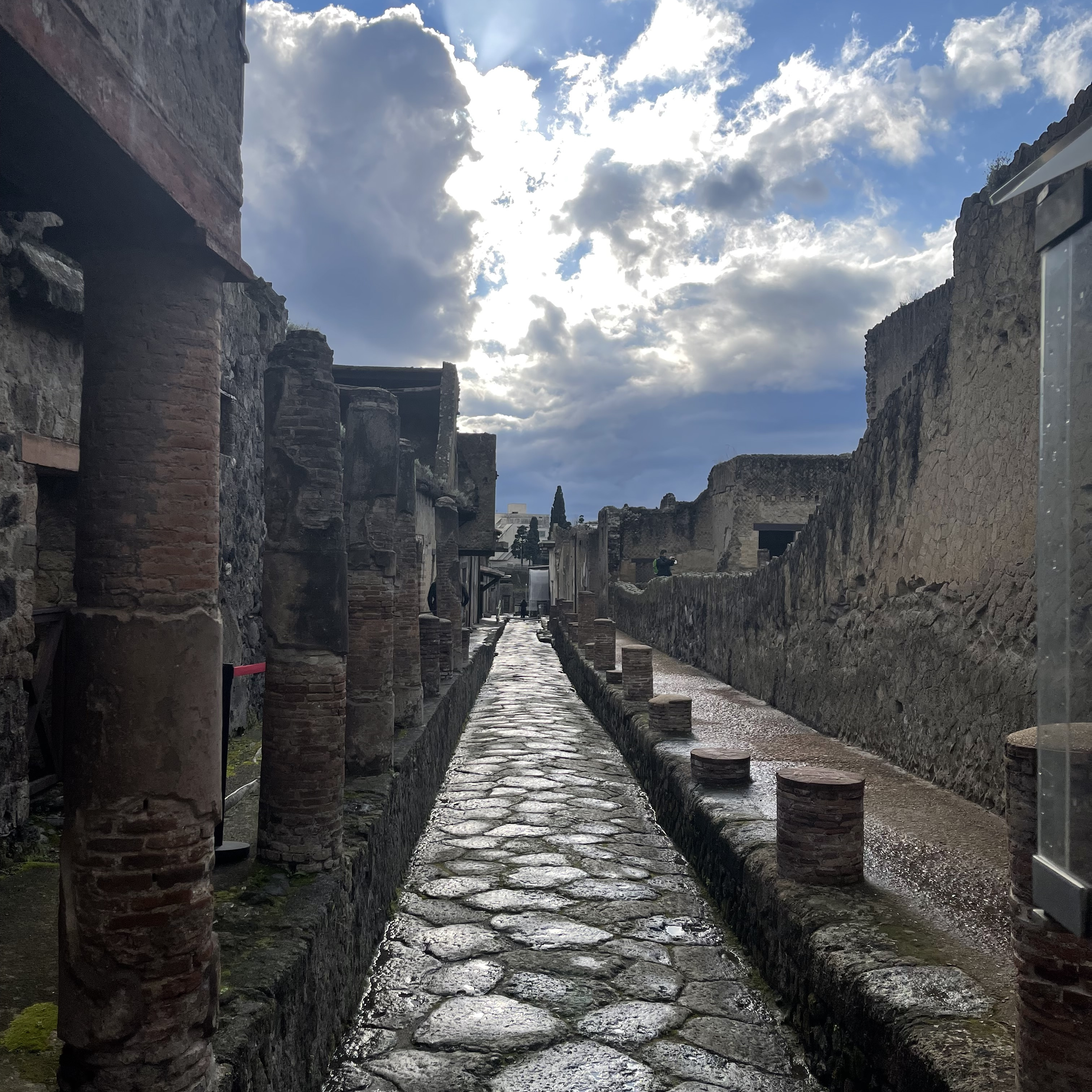
In most Roman cities, the streets were paved. In Pompeii and Herculaneum, pedestrians did not have to get their sandals dirty: High pavements lined the cobbled streets, and raised "zebra crossings" served for crossing, their breaks providing space for donkey carts to pass.
The roads did not look the same everywhere. Soil conditions, the frequency of rainfall and the availability of materials determined the design. In the centre of Cologne, close to the cathedral, you can marvel at a section of a Roman road that led from the city's Roman harbour to the west. This road was part of a right-angled road system that the Romans laid out here. The roads ran from east to west and from north to south. Today, the two main streets, the Cardo maximus and the Decumanus maximus, are covered by the modern shopping streets Hohe Straße and Schildergasse. To this day, the entire centre of Cologne still looks a bit like a chessboard pattern on maps - another Roman legacy of the city.
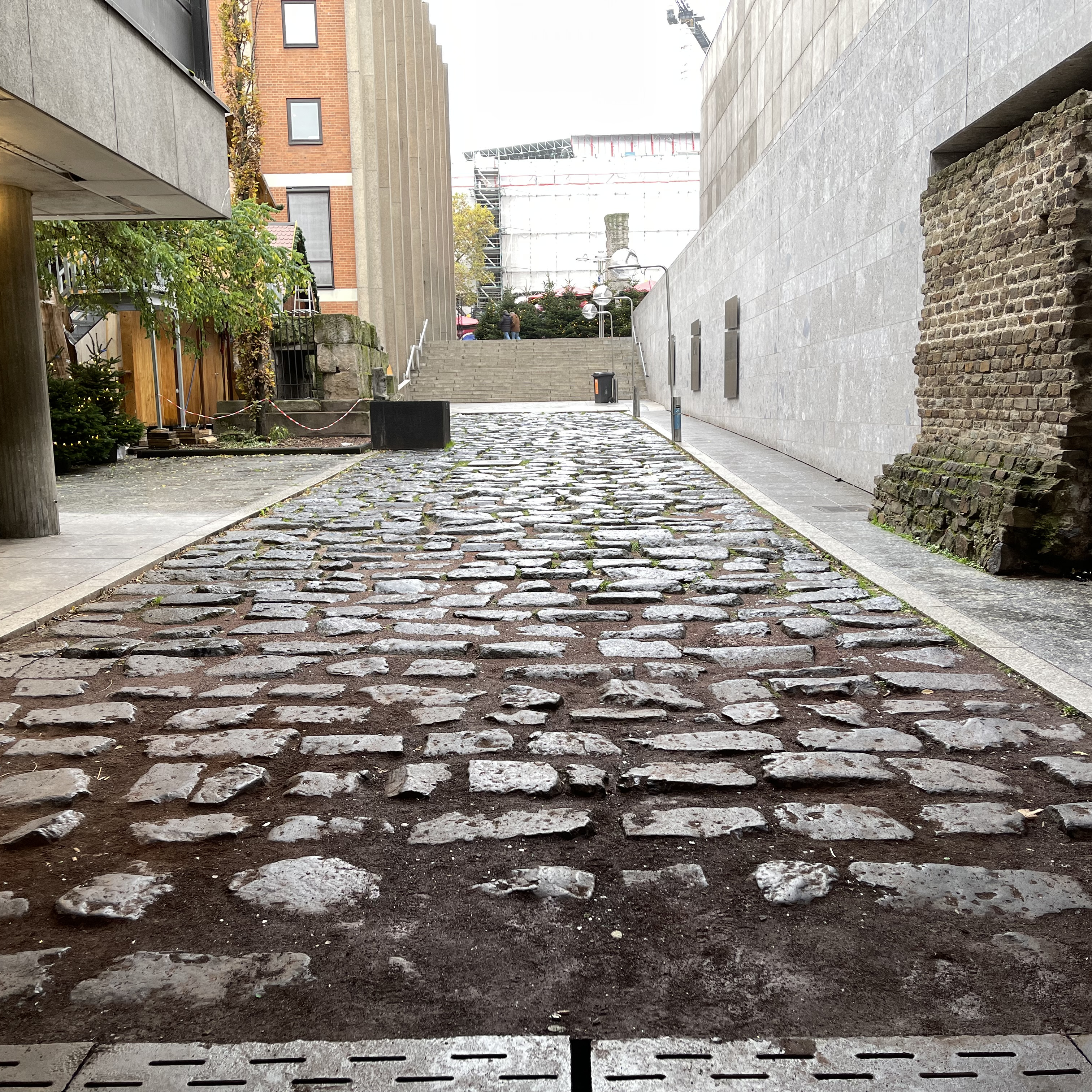
In regions where it often rains and undercutting and erosion can occur frequently, it was particularly important to pave the roads well. The uncovered section of Roman road in Cologne proves that a great deal of material and labour went into this. Only the lowest layer of basalt stones, with which the road was paved at the base, is visible today. Several layers of finer gravel and sand were laid on top and then paved. The result was a surface that was easy to drive on. The cross-section of the road was slightly curved so that rainwater could run off to the side and be channelled away.
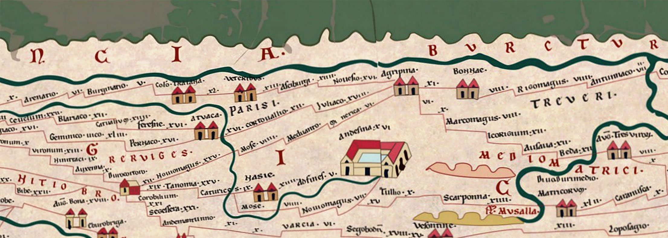
The conquest of the territories north of the Alps was first and foremost a matter of military security. Numerous troops had to be moved and positioned. And while they were stationed there, the soldiers had to be well supplied. To this end, goods were imported over long distances to the deployment areas, even directly from the mother country Italy. Amphorae for olive oil and wine from the Mediterranean region can also be found in the legionary camps of the Augustan period in North Rhine-Westphalia. In Neuss/Novaesium, archaeobotanists were able to identify a whole range of imported goods from areas south of the Alps on the basis of fruit remains. The strategic and rapid movement of soldiers and their reliable supply was therefore the guiding principle for the expansion of a transport route network. However, the civilian population also ultimately benefited from this system. It became much easier to get from A to B. And it was highly likely that travellers, but also merchants and traders, would reach the next vicus, or road settlement in just a few kilometres. The Tabula Peutingeriana gives an impression of this extensive network of transport routes.
The Romans were not the inventors of roads. In Europe, the first paved roads date back to the Bronze Age. In ancient Greece, roads in settlements and paved long-distance roads were already very widespread. This impulse also reached Italy through cultural contacts between the Greeks and Etruscans and through Greek colonisation in the first half of the first millennium BC. The first roads in Italy probably existed even before the mythological foundation of Rome (753 BC) and long before the Roman Republic. Roads were therefore part of the Roman culture from the very beginning and part of the "cultural package" that the Romans later brought with them to the territories they conquered.
The waterways were at least as important as the roads that were built to connect towns over land. Numerous goods were transported on the Rhine, which reached our regions via the Alps or south-western river systems. These were primarily heavy transports with stone building materials and large amphorae. Ships made it possible to carry such heavy loads in large quantities. Travelling downstream was also quite fast and comfortable.
Travelling against the current, on the other hand, was difficult and more suitable for light goods. The ships then had to be towed, meaning pulled by horses, oxen or slaves. However, equipped with sufficiently powerful oarsmen and large sails, Roman ships could also move upstream quite well. In particular, the military fleet, which was stationed in Mainz and Cologne-Alteburg, had to be mobile and patrol the "wet frontier".
For the Augustan legionary camps on the Lippe, namely Oberaden, Anreppen, Dorsten-Holsterhausen and Haltern, it must be assumed that goods were towed upriver in flat-bottomed boats. Stretches of this towpath have not yet been archaeologically documented, as the river has shifted its course over the centuries and old bank reinforcements and paths have been removed. Added to this is the modern transformation of the landscape in the course of industrialisation. However, the use of the river path is logical, as there is also a lack of confirmed Roman roads east of the Rhine and the numerous heavy amphorae excavated at the Lippe camps must have found their way there.
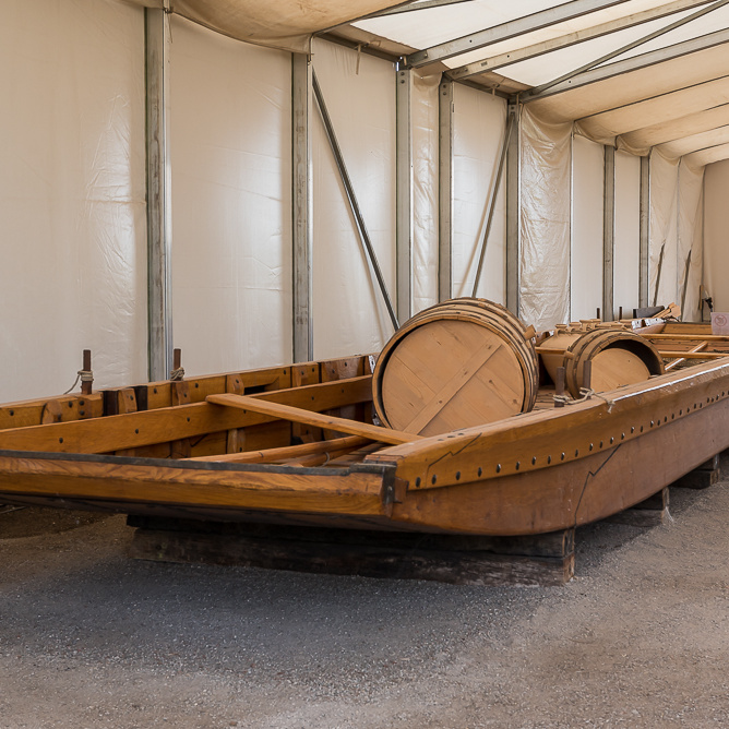
After the Battle of Varus in 9 AD, the Romans withdrew from the area on the right bank of the Rhine. The Rhine became the border and the main transport axis for supplying Roman troops between the edge of the Alps and the North Sea coast. Depending on the section of the river, special ships had to be used. In the regions where the river was deep and the banks rather steep and rocky, different ships were used than in the regions where the banks were shallow and sandy. On the shallower Lower Rhine and its small tributaries, flat-bottomed ships were mainly used which could simply slip onto the shallow banks, similar to ferries. The cargo ships that travelled along the upper section of the Rhine south of Cologne had a deeper draught and moored laterally on the banks. This functional differentiation of ships into "Oberländer" and "Niederländer" can still be found in modern times. For overseas transport to Britain, different ships were needed that could withstand the waves at sea. Long water routes therefore required more frequent reloading of goods.
The Roman river harbours are not comparable to the Roman harbours in the Mediterranean, of which there are numerous ancient depictions. Navigation on rivers is generally much more challenging because special currents have to be taken into account. In the Roman cities of Cologne (CCAA) and Xanten (CUT), there is evidence of wooden quays where ships could land. In both cases, these were so-called parallel harbours, meaning that the ships docked at the side. A distinction is made between four types of modern river harbours.
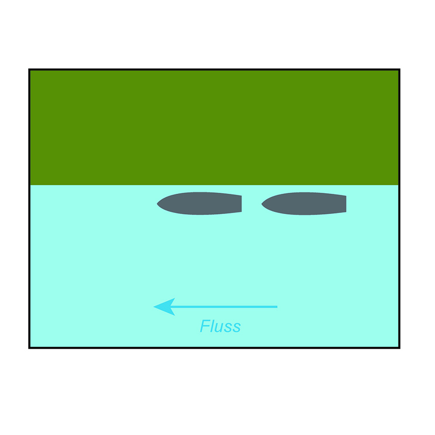

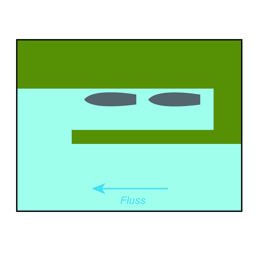
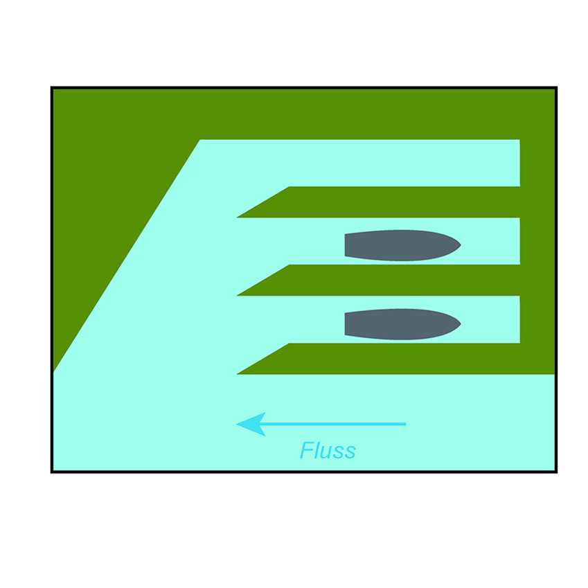
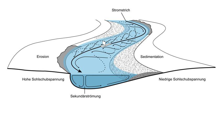
So far, only the parallel harbour type can be confirmed for the Roman period in North Rhine-Westphalia. On unpaved banks, in shallower waters and on the sandy inner edge of a river bend, however, it was only possible to moor with a flat-bottomed boat. At more populated Roman sites on the Lower Rhine, where larger quantities of goods had to be handled, for example in the city of Colonia Ulpia Traiana and at all military sites, the Romans favoured the cut bank with its steep embankment as a harbour position.
In the outer bend of the river, where the water "bounces" against the bank, natural erosion ensured that the harbour did not silt up and that heavily laden ships had sufficient sailing depth. The exact landing points are not always archaeologically verifiable. However, the remains of bank reinforcements that stabilised the currents around the harbours can still be found in many places. Similar to today, many river ships probably docked at floating landings that reacted flexibly to different high and low water levels. There is no possibility of finding archaeological evidence of such floating wooden structures. A wooden gangway could also serve for loading and unloading, which we can see in many pictorial representations. The labourers walked with the goods over the gangway laid out from the quay to the ship.
Until the early 2nd century, Roman Cologne still had an island in front of it in the Rhine, which was separated from the city bank by an arm of the river. This initially provided a natural current shadow into which ships could sail. However, this arm of the Rhine soon silted up, so that the eastern side of the former island had to serve as a parallel harbour.
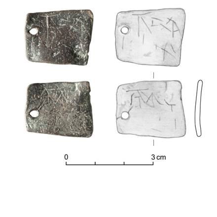
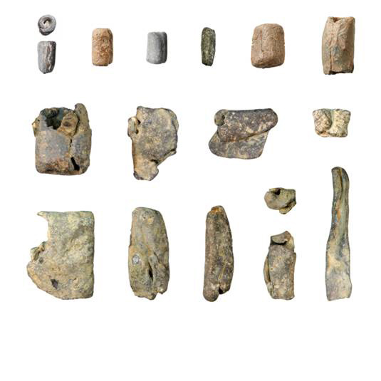
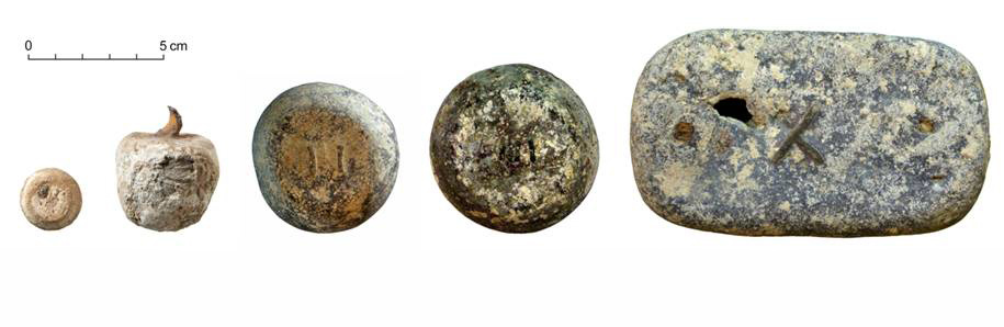
If there is a lack of clear architectural structures, relevant finds such as goods labels, weights and lead fishing utensils often suggest that a harbour could have been located at the site in question. However, due to the ongoing natural and man-made changes to the river landscape, the exact appearance of Roman inland harbours can no longer be reconstructed with absolute certainty.